

First geographical map to survey areas threatened by earthquakes and floods in Algeria

الشروق أونلاين
-
-
1251
-
0
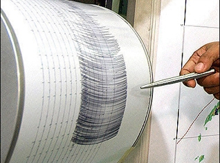
Algeria completed the preparation of the first geographical map, on the seismic risk areas, especially in the northern areas of the country and the highlands, as they are the most vulnerable of earthquakes, as the map identified the sites the most vulnerable to floods and industrial hazards, which would allow the use of the map as a means of work for many services to classify the restricted areas for the establishment of buildings, in order avoid losses.
-
The map of identifying seismic danger and the areas of activity is the first map developed in this area and it is the result of the efforts of a team of engineers and technicians at the Center for Researches in Astronomy and Astrophysics and Geophysics, in collaboration with the Chinese administration of earthquake.


